1860 Carriage Road
Pinkham Notch
Gorham, N.H.
June 19th, 2018
Long before the construction of today's 7.6 mile-long Auto Road, a rock-strewn carriage road serviced Mt. Washington, allowing visitors a chance to reach the summit by horse. The carriage road officially opened in 1860 but has long since been forgotten. Today, a ghost of this primitive road is all that remains, crisscrossing and running parallel to the ever-busy Auto Road.
Many books, including 'Not Without Peril,' provide a detailed history of the original carriage road, it's construction, location, and various mishaps and fatalities that occurred along the path. It is not my purpose to provide the same historical details here, but to merely present images that capture this hauntingly beautiful path, as well as to provide the information you need to find it and enjoy it yourself.
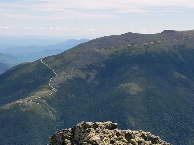
The images above, as seen from Mt. Adams, show the course of the original carriage road. Beginning just after the original 'Halfway House' location, and shortly after the current 4 mile marker, the path of the road is easily located. I've highlighted the Carriage road's path in red.
Based upon my experience, I can tell you that the the carriage road itself was approximately 15 feet wide, with a rocky cobblestone-like floor. On either side of the road stood 5 foot tall wooden post placed approximately every 20-30 feet. Each wooden post was connected by 3 layers of metal wire, effectively creating a fenced-in bounded path for the horses to travel safely with decreased risk of navigating off the road.
From the Auto Road, just past the Halfway House historical foundation, the carriage road ascends a clear, wide path, then bends east as it continues it's ascent toward the summit. At one point, the path splits left and right. The left branch of the Carriage Road, as I would discover on my descent, continues up and connects to the higher portion of the dirt section of Auto Road between miles 4 and 5. The right spur continues upward, through a 50 foot section of heavy vegetation, then tops out at the junction of Auto Road and Wamsutta trail sign. At this point, the path of old Carriage Road becomes very difficult to discern.
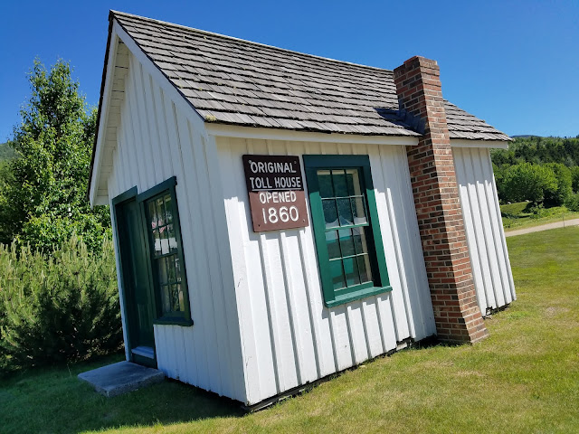 |
| This is the original 1860 Carriage Road 'Toll House.' |
|
 |
| Shortly after the 4 mile marker, on the Auto Road, one will find the original Halfway House foundation as well as the beginning of the Carriage Road. |
 |
| The bend just after the 4 Mile Marker. |
 |
| Just beyond this lot, one will find the 1860 historical Halfway House foundations and start of the Carriage Road. |
 |
| Halfway House |
 |
| Historical stone wall, just Southeast of the Halfway House foundation. |


 |
| In 'Not Without Peril,' this may have been the location of a historical death. How many stones have 2 holes in them? |
 |
| As you leave the Halfway House location, the original road appears to continue upward toward this Mt. Washington Observatory weather mesonet tracker. |
 |
| As you leave the eastern side of the Auto Road and the Halfway House foundation, you will cross a skimpy boundary fence that leads you back toward the paved safety of Auto Road. It appears that this was built to persuade tourists not to venture beyond. |
 |
| This is the beginning of the Carriage Road from the western side of the Auto Road. It's pretty unmistakable. When you see it, you will know ! |
 |
| The path continues up, away from the Halfway House. |
 |
| Slightly overgrown, the path continues, gradually becoming less overgrown. |
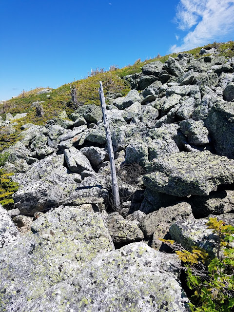 |
| Side-posts appear, marking the lateral borders of the road. |
 |
| A side-post, with metal fencing still intact. |
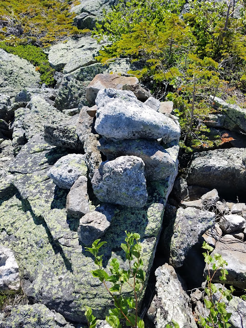 |
| All along the Carriage Road you will find ancient cairns, marking the path, as well as subtle trail-spurs off of the road leading to 1860 camps littered with the tools, nails, and spikes left behind. |
 |
| History......... |
 |
| As the road rises, the Northern Presis begin to tower above. |
 |
| The 1860 Carriage Road banks hard-west, continuing toward the summit. |
 |
| Mother Nature is erasing this road. |
 |
| Approaching the left-right split. Left ascends to the 5 mile marker. Right ascends to the Wamsutta junction. |
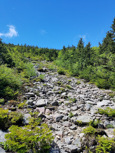 |
| The left-right split. |
 |
| Just after the Wamsutta junction with Auto Road, it is clear that the original road continues upwards. I attempted to travel approx 1/4 mile beyond this point, but a combination of heavy wind and thick scrub changed my plans. |
 |
| Treaure. |




No comments:
Post a Comment